The Monticello Entrance Hall houses a number of historical maps depicting states, countries, and continents. Each one tells a story about what was once known about the world and by whom. In this episode of Mountaintop History, Monticello Guide Kyle Chattleton shares some of this history.
This is Mountaintop History, a podcast from the Thomas Jefferson Foundation at historic Monticello. My name is Kyle Chattleton.
If you visit Monticello today, you’ll find a number of maps in the Entrance Hall. Thomas Jefferson acquired over 300 maps, globes, and atlases during his lifetime, a reflection of his belief in the power of knowledge and education. To this day, each one tells a story about what Jefferson and others knew about the world, as well as a little bit of history about the past.
Consider, for example, an 1802 map of the continent of Africa. The map was made by Aaron Arrowsmith, a London mapmaker. Much of the interior of the continent is empty, marking through blank space the fact that Europeans like Arrowsmith knew little about Africa. To make this point even clearer, Arrowsmith details a major mountain range running right through the middle of the continent, a mountain range that does not exist, but would appear in European maps of Africa for decades. What is well-detailed on this map, however, are the centers of the transatlantic slave trade along the western coast.
This map of Africa is displayed towards the left of the Monticello Entrance Hall, and as you look right, you’ll find another map made by Arrowsmith, this one also from 1802. It depicts the United States of America and its sixteen states. Ohio would join the Union next year, but soon after the map of the country would have to be redrawn due to the Louisiana Purchase, which doubled the size of the United States’ territory, but also involved claiming and seizing land that had been the home of many Native American nations. Arrowsmith’s 1802 map of the United States had drawn upon other maps created by some of these same nations.
And finally, further to the right in the Entrance Hall, hanging above some fossilized remains of Ice Age creatures, is Thomas Jefferson’s copy of a map of Virginia that his father, Peter Jefferson, made along with Joshua Fry. The original was made in 1751, at the request of the colonial government of Virginia. While Thomas Jefferson undoubtedly took pride in his father’s work and this map, perhaps the British found it to be useful during the American Revolutionary War.
This has been another edition of Mountaintop History, a collaboration between WTJU and the Thomas Jefferson Foundation. To learn more, and to plan your next visit, go to Monticello.org.
Maps Gallery

Detail from an 1802 map of Africa by Aaron Arrowsmith
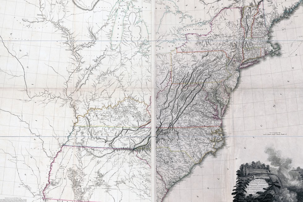
Detail of Aaron Arrowsmith's 1802 map of the United States
 Play
Play
The Fry-Jefferson Map of Monticello


